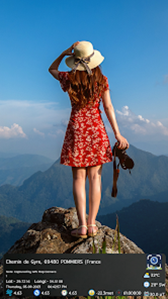
GPS Map Camera: A Comprehensive Geotagging Tool
GPS Map Camera Geotag Location is a versatile multimedia application designed for Android users, focusing on photography and geotagging. This free app allows users to add GPS location stamps, including latitude, longitude, altitude, and date/time information to their photos. It features customizable templates where users can modify elements like weather conditions, compass information, and notes. The app also supports unlimited photo folders for better organization of images, making it ideal for travelers, explorers, and professionals in fields such as real estate and surveying.
In addition to photo geotagging, the application includes a GPS area calculator that enables users to measure land areas accurately. With various measurement modes and the ability to save and edit measurements, it caters to users who require precise land calculations. The user-friendly interface ensures that both casual users and professionals can navigate the app with ease. Overall, GPS Map Camera serves as a valuable tool for anyone looking to enhance their photography with location-based details.